Vision+ Utility Flight Logger Dashware

Luap said:
Finally, the raw file is roughly twice as large as the csv file. What other data is there that account for the size difference?

To minimize the sampling rate, our app did not do any computation to decode the telemetry data while the logger is on. The decode is done after the logger is off. thats why the raw file size is twice as csv file size.
 
DBS said:
Luap said:
Things that I am still missing:
In the CSV file there should be a column indicating Max speed - Not the max speed from the total logged time, that can be calculated in Dashware and is the same value throughout but the maximum speed from the start of log to current time played.
Same for average speed.
Could you have this added in the CSV file?
Flytrex seems to have this in theirs.

Dedicated my morning to doing some logging and putting together a Dashware video with the Utility Pro logger file... looks like everything is working very well indeed... battery... sat count... pitch... roll... and yaw are all trackable and looks like everything is syncing up real nice...

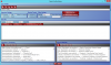
I wanted to include the column headings from a flytrex csv file and see if a couple other things can be included in the Utility Pro csv file as luap suggested above...

Flytrex columns are as follows...

latitude,
longitude,
altitude(feet),
ascent(feet),
speed(mph),
distance(feet),
max_altitude(feet),
max_ascent(feet),
max_speed(mph),
max_distance(feet),
time(millisecond),
datetime(utc),
datetime(local),
satellites,
pressure(Pa),
temperature(F)

I'm wondering if "pressure" and "temperature" would be available?... I like all the little details I can get in my data if possible sir... Thank you for all the hard work... This is really getting locked in and running sweet :ugeek:

"pressure" and "temperature" are not available in DJI telemetry data. but we would like to add a SNR Signal-to-Noise Ratio to the log. The SNR ratio may be useful for you to tune your antenna setting.
 
flyNfrank said:
Please keep on keep on asking ocatcr to add the data and columns. I have asked many times the same stuff you guys are asking for. I have also put in countless hours with the dashware stuff as a result of not having the mentioned data.
You could actually add your custom COLUMN MAPPINGS from the existing data. More info at http://www.dashware.net/faq-items/want- ... -dashware/
 

Attachments

  • 0.png
    0.png
    219.7 KB · Views: 480
I guess my question is the below is everything that is available on the dashware data network. There is nothing else passed on the network?

latitude
longitude
altitude(feet)
ascent(feet)
speed(mph)
distance(feet)
time(millisecond)
gps
power
pitch roll
yaw
motor on
 
ocatcr said:
"pressure" and "temperature" are not available in DJI telemetry data. but we would like to add a SNR Signal-to-Noise Ratio to the log. The SNR ratio may be useful for you to tune your antenna setting.

I like how that sounds... this would be a great addition for testing the boost applications and various boost levels available for the cleanest solution :ugeek:
 
Is Dashware the best option out there for this? I find their compression to be really bad and I've fallen into a black hole with their support.
I've seen RaceRender, it wasn't really canned for flying.
 
ocatcr said:
Luap said:
Altitude: The difference in altitude is logged basis take off altitude but take off altitude logged is always = 0.
The actual altitude is not recorded. I take off at 500m above sea level.
Is the data not available in the raw file? Could you add this in the csv?

The real altitude is not available from the telemetry data. Now the Altitude value is same as the one shown in DJI Vision app. ascent(feet) value is defined as (current Altitude - takeoff Altitude). We heard that one uses google earth to have the altitude of where phantom takeoff and then compute the real altitude via Excel. Any other suggestion?

There might be a calculator for this in the Edit Profile that you would add to the profile. It should be able to calculate the elevation based on longitude and latitude. Btw, that calculator may show up in flytrex logger profile since their profile is already set to show elevation.
 
ocatcr said:
flyNfrank said:
Please keep on keep on asking ocatcr to add the data and columns. I have asked many times the same stuff you guys are asking for. I have also put in countless hours with the dashware stuff as a result of not having the mentioned data.
You could actually add your custom COLUMN MAPPINGS from the existing data. More info at http://www.dashware.net/faq-items/want- ... -dashware/

You are exactly right. And as long as the flight logger is set to log the data, it's just a matter of someone creating a gauge that displays the readout.

If someone does not know how to do this, or doesn't want to take the time to learn how to, the best option might be to ask someone that has done it if they will share their file with you. They would just email it to you and you drop it in the necessary location.
 
ocatcr said:
flyNfrank said:
DBS said:
Ok I gotcha... yeah that's a weird one... that was one of the gauges I messed around with today... The map with the yellow line and also the blue... and they both worked fine... I was trying to make the red dot appear as an actual Phantom flying along the GPS track (I got that by the way) but then I didn't add that gauge to the video because I was only flying in a straight line this morning so it was kind of a boring gauge...

I was confused by your previous comment where you said data missing "mostly vertical data" ... The map gauge points to latitude and longitude for it's targets ... What vertical data did you mean?

Well, the map gauge as I call it has never worked correctly. I can go fly 100% straight up and straight down, and the map would look like a birds nest. I worked on it some and finally got the horizontal part working great, but soon as I would climb vertically the line would go crazy. We both tried emailing dashware support but they never responded back.

Did you try to plot it in google earth with using the kml output and then post the result here.

OCATCR....When placing the .kml file in google earth is shows up messed up just as it does in dashware. In both csv and kml it shows I climbed to altitude 31,000ft. But when viewing it from the top down or from above looking straight down, that part looks ok.

As I said in the email, the data is ok using flytrex logger profile. I'm having the trouble I am because you updated the Vision+ Utility logger profile without sending me the updated version.
 
ocatcr said:
Luap said:
Things that I am still missing:
In the CSV file there should be a column indicating Max speed - Not the max speed from the total logged time, that can be calculated in Dashware and is the same value throughout but the maximum speed from the start of log to current time played.
Same for average speed.
Could you have this added in the CSV file?
Flytrex seems to have this in theirs.

Could we know why the maximum / average speed are computed in this way?

For example I want to see how fast I can get to in a speed run -sort of like drag racing - and see gs for accelaration and decelaraton.
See what I mean in this video.
[youtube]http://www.youtube.com/watch?v=3W7fRMW6egA[/youtube]

The speed Gauge is still very raw.

I calculated max speed for now in excel using the max function and saved as csv- but if you could add this when converting the raw to csv it would spare me a step.
 
Luap said:
The speed Gauge is still very raw.

I calculated max speed for now in excel using the max function and saved as csv- but if you could add this when converting the raw to csv it would spare me a step.

Great work Luap!!

This is getting more and more useful every day with everybody working on it like this...

All hands on deck and working towards making this by far the best add on app for the Vision + :!:

Keep it up guys... don't get frustrated with the work in progress... stuff like this is what R&D is all about :ugeek:
 
rrmccabe said:
I guess my question is the below is everything that is available on the dashware data network. There is nothing else passed on the network?

latitude
longitude
altitude(feet)
ascent(feet)
speed(mph)
distance(feet)
time(millisecond)
gps
power
pitch roll
yaw
motor on

you could use Flytrex profile or our sample profle download/file.php?id=9525
 
flyNfrank said:
As I said in the email, the data is ok using flytrex logger profile. I'm having the trouble I am because you updated the Vision+ Utility logger profile without sending me the updated version.

please email us the raw file. we could test it.
 
Luap said:
ocatcr said:
Luap said:
Things that I am still missing:
In the CSV file there should be a column indicating Max speed - Not the max speed from the total logged time, that can be calculated in Dashware and is the same value throughout but the maximum speed from the start of log to current time played.
Same for average speed.
Could you have this added in the CSV file?
Flytrex seems to have this in theirs.

Could we know why the maximum / average speed are computed in this way?

For example I want to see how fast I can get to in a speed run -sort of like drag racing - and see gs for accelaration and decelaraton.
See what I mean in this video.
[youtube]http://www.youtube.com/watch?v=3W7fRMW6egA[/youtube]

The speed Gauge is still very raw.

I calculated max speed for now in excel using the max function and saved as csv- but if you could add this when converting the raw to csv it would spare me a step.

Great work! Is it easy to build a Artificial Horizon Gauge?

Your suggestion is added to our TODO List :D
 
Ok since we are finally getting some additional followers I set a area up where we can share files. I think most of you are already a member, so just click on link below and I have a thread named "Logger Profile Dashware". The instruction for adding a Logger Data Profile to your current list are included in the link below.

http://forums.multicopterpilots.com/vision-utility-app/

Btw, I will post some pics on what all my Logger Profile will work with in whatever gauge. Just need a little time.
 
ZAPPATA007 said:
Hi; can all this be seen live while on fpv ?
The recorded video along with the output from the logger is post-processed with an app such as DashWare to produce video with overlaid gauges, charts, maps.
 
flyNfrank said:
Ok since we are finally getting some additional followers I set a area up where we can share files. I think most of you are already a member, so just click on link below and I have a thread named "Logger Profile Dashware". The instruction for adding a Logger Data Profile to your current list are included in the link below.

http://forums.multicopterpilots.com/vision-utility-app/

Btw, I will post some pics on what all my Logger Profile will work with in whatever gauge. Just need a little time.

I tried to register but it says my email is banned. :shock: That's what I get for being an ***, I guess.
 
I like this app but I sure wish they would update the iOS app with a lot of the goodies that they are putting into the Android version. Call me a whiner if you want to, but we paid for the app too.


.
 

Members online

No members online now.

Forum statistics

Threads
143,108
Messages
1,467,692
Members
104,993
Latest member
canadiansauna