My P3P crashed, DJI not cooperating

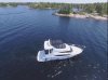
OK, so then I thought, what if the AC lost altitude (without stick input) over the course of the flight and the baro didn't register it. Or what if the baro wasn't reading right and was indicating 1.5x the actual height. So I plotted throttle stick against GPS altitude and got basically the same graph as above, only with fatter lines because GPS altitude is not as accurate. Maybe the space time continuum is warped in that area and that little bay is actually 40 feet higher than the takeoff point? ;) Is there any condition imaginable where water could be at a higher level in that area? I don't see how, but no matter how many ways I cut this mystery, I can't solve it.

Mike
 

Attachments

  • p3pplotgps.jpg
    p3pplotgps.jpg
    129.1 KB · Views: 269
  • Like
Reactions: General Chaos
So I plotted throttle stick against GPS altitude and got basically the same graph as above, only with fatter lines because GPS altitude is not as accurate.
GPS altitude isn't just a bit less accurate .. it's very inaccurate and and the values swing large amounts over short periods.
GPS altitude data is worthless.
 
A big thank you to everyone for their input. Its greatly appreciated as the analysis of these logs are way beyond my technical expertise. I purchased this drone knowing it was full of technology which drew me to this brand over others. I did my research and tried my best to have a good understanding of the functionality before flying. My flights are always very controlled and I'm very careful and aware of my surroundings. Ive read on this forum about many crashes and I promised myself that would never happen to me yet here I am....

I have emailed DJI asking them to reconsider their offer of 20% purely on the basis that there was some anomaly that contributed to the crash. Looking in detail at the chain of events, maybe it would have crashed anyway but there is a chance that it may have survived. I really appreciate Mike's input as his analysis most accurately represents what I witnessed on that tragic day.

It seems the RTH function works well assuming it doesn't engage while you are attempting to land where your negative throttle used while landing also cancels the auto climb to the pre-programmed RTH altitude. Thats precisely what happened here directly resulting in the crash. If its OK with you Mike, I would like to share your analysis with DJI as you articulated it far better that I could ever do.

Whatever the outcome, I plan to be back flying very shortly. Thanks again for all your help !
 
The barometer isn't going to snap and suddenly start reading 40 feet more - and the flight data doesn't indicate it did anyway.
If the barometer/IMU was out of calibration and drifting, that should show in previous flight records.
These can be checked for start height vs landing height to see if the Phantom showed a regular pattern of barometer shift during a flight.
But this won't change anything.
The height of the point of impact doesn't matter.
The circumstances have been gone over several times.
The Phantom was in RTH, nearby and in visual range.
It's ascent was cancelled and it was allowed to crash into something in plain view, at whatever height.
There are a lot of things a pilot has to understand about how the Phantom works and inexperience and confusion leads to crashes like this.
 
From log RTH initiated because of low battery. RTH set at 30Meters altitude.
969.378 : 659133 : 54718 [Ctrl<11>] REQ_BATTERY NAVI_GO_HOME ctrl_navi_go_home
Yellow line shows heading its taking after go home initiated.
Baro and GPS altitude were inaccurate but VPS (OSD.sWaveHeight [m] in txt log) shows lower altitude (éess than 5 meters throughout part of the flight - will look at it further but appears to be incorrect altitude readings from GPS Baro that lead to the crash.
upload_2016-6-15_1-20-49.png
 
It seems to me that the RTH cancelling the RTH height if the bird is descending when RTH is initiated will lead to more crashes. Hopefully they will remove this feature. Am I missing something that would make this feature beneficial?
 
The barometer isn't going to snap and suddenly start reading 40 feet more - and the flight data doesn't indicate it did anyway.
If the barometer/IMU was out of calibration and drifting, that should show in previous flight records.
These can be checked for start height vs landing height to see if the Phantom showed a regular pattern of barometer shift during a flight.
But this won't change anything.
The height of the point of impact doesn't matter.
The circumstances have been gone over several times.
The Phantom was in RTH, nearby and in visual range.
It's ascent was cancelled and it was allowed to crash into something in plain view, at whatever height.
There are a lot of things a pilot has to understand about how the Phantom works and inexperience and confusion leads to crashes like this.

The flaw in your reasoning is that the AC is never supposed to RTH at an altitude of only 5m (as it did). It was the mechanical failure of the baro sensor was a big factor in what caused the crash because the RTH altitude is only supposed to be "cancelable" once the AC reaches 20m, meaning that the minimum RTH altitude should always be at least 20m (65 feet). From the looks of it, that would have easily cleared the rock and would have likely cleared at least the trees in the local area, potentially all of them between the crash site and the home point. Instead of rising to 20m before allowing RTH altitude cancel, it canceled RTH ascent at only 5m (due to the inaccurate altitude reading), giving the pilot only 13 seconds to respond and not allowing the AC to clear nearby objects as it should.

So I feel there's some blame on both sides here.

Mike
 
I just see more opportunities for failure than success RTH, turn the bird on the home line, and fly it back.

Mike

Yeah you're probably right it could be a more complicated gesture for how often it gets used and I would be satisfied. It is definitely too easily performed for someone that didn't RTFM as most often dont. Hell I'm guilty also before getting scared enough to smarten up.
 
It increased up to 106' at one point I believe but I don't see any abrupt unexplained changes in altitude throughout the flight.

It's not an abrupt change I'd be looking for but rather a moment where the stick says go down but barometer remains locked. That is how I would expect a stuck barometer to present in logs maybe confirmed by motion in the other altitude sensor? (Guessing) 2 sensors report altitude or am I wrong? Is it gps? That's what I expect if you are lucky enough to find that.
 
The flaw in your reasoning is that the AC is never supposed to RTH at an altitude of only 5m (as it did).
Going by the log only, it shows the AC ascended to 65 feet (the minimum altitude) and then started going home.
 
It's not an abrupt change I'd be looking for but rather a moment where the stick says go down but barometer remains locked. That is how I would expect a stuck barometer to present in logs maybe confirmed by motion in the other altitude sensor? (Guessing) 2 sensors report altitude or am I wrong? Is it gps? That's what I expect if you are lucky enough to find that.

I'm way out of my league here .... I can only rely on the expert opinions of others here. I have a basic understanding of the logs but beyond that I'm lost.
 
There's more down stick at 960.33 through 961.8 and another batch of 10% to 30% down throttle from 965s through about 969s although those last ~5 seconds of down stick only resulted in a ~1.5m drop in altitude according to the baro.
Mike

And he may have found your pot of gold. That's what I'd be pressuring DJI with. They know they put a bad batch of barometers into the p4 that they're keeping hush because they used a cheap vendor. They've warrantied them AFAIK.

Edit: although I just noticed Mikes chart correlating barometer with stick input... not sure what to make there.

If you convince them it was a failure and get it replaced you owe these guys a few beer.
 
Last edited:
And he may have found your pot of gold. That's what I'd be pressuring DJI with. They know they put a bad batch of barometers into the p4 that they're keeping hush because they used a cheap vendor. They've warrantied them AFAIK.

If you convince them it was a failure and get it replaced you owe these guys a few beer.

I absolutely agree !!!!! There will be PMs going out with gift cards for beer. I appreciate all the work done by these experts and its the least I can do to say thanks !
 
Here's some more interesting information from the log:

15m 15s: Photo 1 (altitude = 96.5 ft)
15m 21s: Photo 2 (altitude = 96.5 ft)
15m 25s: Photo 3 (altitude = 96.5 ft)
15m 27s: Photo 4 (altitude = 96.5 ft)
15m 39s to 15m 40.2s (1.2s total): Throttle stick up average of 65% (altitude increased from 95.8 ft to 101 ft)
15m 44.8s to 16m 1.8s (17s total): Throttle stick down average of 36% (altitude decreased from 105 ft to 66.3 ft)
16m 4.9s to 16m 9.4s (4.5s total): Throttle stick down average of 23% (altitude decreased from 66.3 ft to 62.3 ft)
16m 9.5s: RTH initiated (altitude = 62.3 ft)

Note: See the photos below for a reference point. It appears an altitude of 96.5 feet could be accurate at those points in time.
 

Attachments

  • 1.jpg
    1.jpg
    109.3 KB · Views: 308
  • 2.jpg
    2.jpg
    101.5 KB · Views: 304
  • 3.jpg
    3.jpg
    88.4 KB · Views: 276
  • 4.jpg
    4.jpg
    91.3 KB · Views: 290
Going by the log only, it shows the AC ascended to 65 feet (the minimum altitude) and then started going home.

I could certainly be wrong, but I don't see any ascent (according to the barometer) at the "go home" point: it didn't ascend because it already thought the altitude was 19 meters at that point. I mean, a little later, I see 19.8 but a 0.8 meter rise is in the noise. So if the actual altitude was about 5m at that point (pilot estimate), it would have only risen another meter to reach the minimum RTH altitude which would have put it at 6m (just under 20 feet) actual.

Mike
 
Here's some more interesting information from the log:

15m 15s: Photo 1 (altitude = 96.5 ft)
15m 21s: Photo 2 (altitude = 96.5 ft)
15m 25s: Photo 3 (altitude = 96.5 ft)
15m 27s: Photo 4 (altitude = 96.5 ft)
15m 39s to 15m 40.2s (1.2s total): Throttle stick up average of 65% (altitude increased from 95.8 ft to 101 ft)
15m 44.8s to 16m 1.8s (17s total): Throttle stick down average of 36% (altitude decreased from 105 ft to 66.3 ft)
16m 4.9s to 16m 9.4s (4.5s total): Throttle stick down average of 23% (altitude decreased from 66.3 ft to 62.3 ft)
16m 9.5s: RTH initiated (altitude = 62.3 ft)

Note: See the photos below for a reference point. It appears an altitude of 96.5 feet could be accurate at those points in time.

That's definitely interesting. By looking at those photos, that doesn't look anywhere near 96.5 feet. Looks more like 40 or 50.

Mike
 
16m 4.9s to 16m 9.4s (4.5s total): Throttle stick down average of 23% (altitude decreased from 66.3 ft to 62.3 ft)

Something fishy right here imo when considering above avg 36% for 17s and net result loss compared to measly 4 ft loss here.
 
Here's some more interesting information from the log:

15m 15s: Photo 1 (altitude = 96.5 ft)
15m 21s: Photo 2 (altitude = 96.5 ft)
15m 25s: Photo 3 (altitude = 96.5 ft)
15m 27s: Photo 4 (altitude = 96.5 ft)
15m 39s to 15m 40.2s (1.2s total): Throttle stick up average of 65% (altitude increased from 95.8 ft to 101 ft)
15m 44.8s to 16m 1.8s (17s total): Throttle stick down average of 36% (altitude decreased from 105 ft to 66.3 ft)
16m 4.9s to 16m 9.4s (4.5s total): Throttle stick down average of 23% (altitude decreased from 66.3 ft to 62.3 ft)
16m 9.5s: RTH initiated (altitude = 62.3 ft)

Note: See the photos below for a reference point. It appears an altitude of 96.5 feet could be accurate at those points in time.


I'm no expert but simple logic shows that the Phantom DID NOT fly back at 62.3 feet. If it did, it would have flown over the rocks and shrubs into the trees which is NOT the flight path shown in the logs.
 
That's definitely interesting. By looking at those photos, that doesn't look anywhere near 96.5 feet. Looks more like 40 or 50.

Mike
I agree and as a skydiver we are trained for altitude awareness as a skill to progress.
I am far from expert with 54 jumps but my first guess was ~50ft also using boat size as point of reference.
 

Recent Posts

Members online

Forum statistics

Threads
143,094
Messages
1,467,604
Members
104,979
Latest member
ozmtl