When it can, DatCon will produce a .csv that is 1) compatible with Dashware and 2) is consistent with the .csv derived from the DJI Go App .txt file. It can't always do this and that's why the time scale stuff is complicated. Usually, it's not necessary to understand this stuff - just use the offsetTime scale.
@Luap and I assumed that if a user were doing something that required understanding the time scale stuff then they would already be expert enough to understand it.
I reviewed the manual - pages 0.5 to 2.0 (it's been a long time since I wrote it). If you had some questions that would help me understand what needs further explanation.
Depending on what you're doing you might want to try using CsvView instead. It fixes all that complexity by not allowing you to make choices
")
. CsvView is kinda like using the Excel plot package, only a lot easier. It's also kinda like using Dashware without the eye candy factor. CsvView can be obtained by going
here.
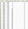
There are a couple of reasons that .DAT files can have the same date/time stamp. Take a look at the bottom half of this
page. If they come from the same flight there is an app called DatMerge that will merge them into one .DAT. I haven't released DatMerge to the general public because I haven't gotten around to implementing a GUI. I.e., it has to be run from a shell (command line interpreter). Most users don't know how to do this. PM me if you want a copy of DatMerge