I've had the privilege of working with an amazing company since last February as they developed a great new app and website called Hivemapper. The are a bunch of smart and dedicated guys. Today they start their public beta and announced a new round of funding! Their tag line is:
Never fly alone.
Explore further. Fly safer. Plan better.
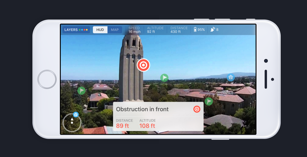
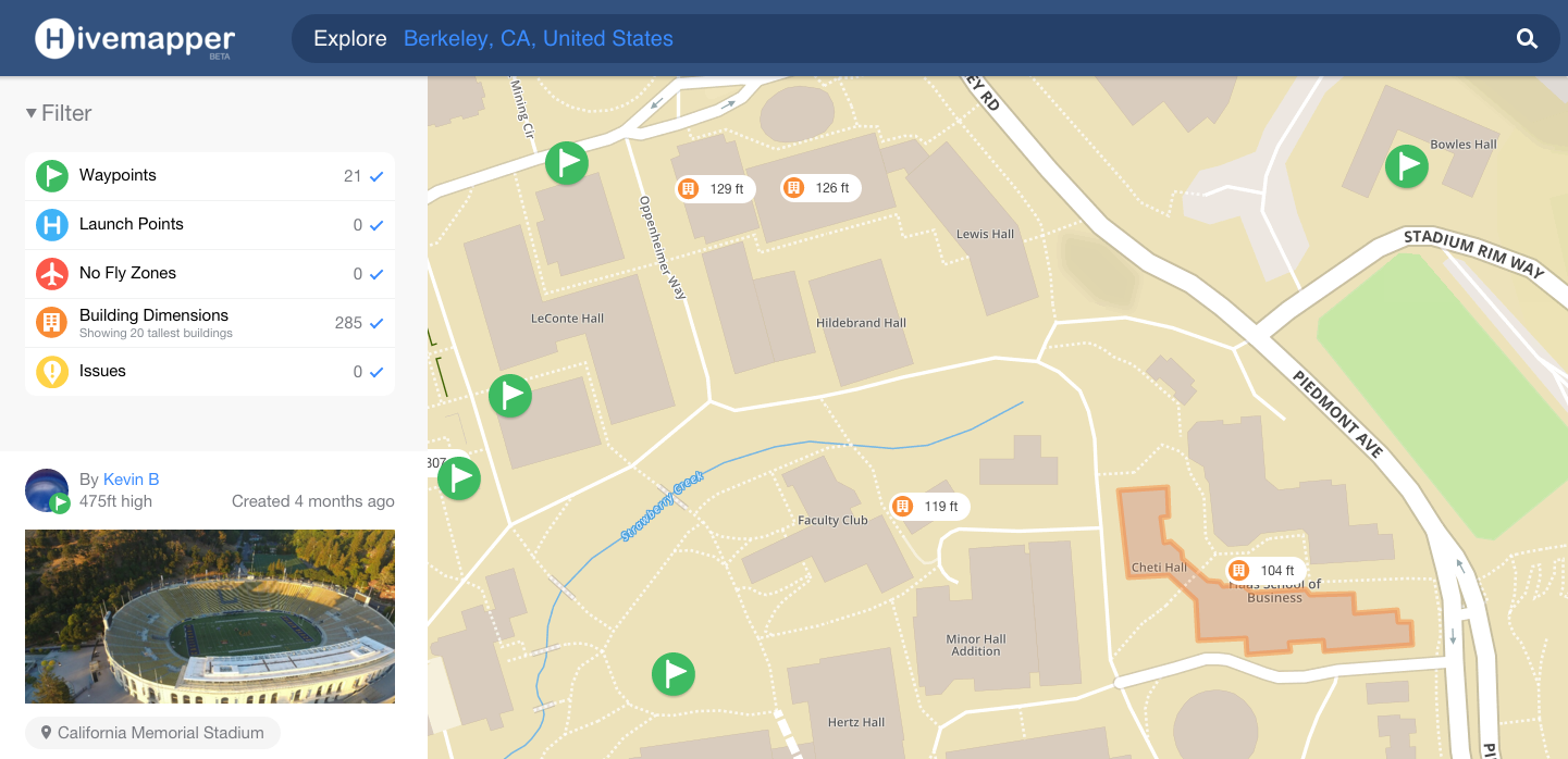
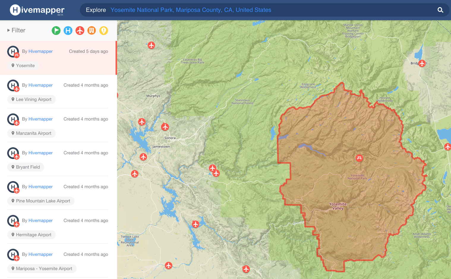
You can use their app to fly your drone (P3P, I1, P2V+) accessing an amazing amount of data while you fly. You can share pictures you take and other things you find that might help the community. They show you building heights (20 million in the US) and points of interest in your FPV while you fly and surround obstacles like buildings, antennas etc with a zone of safety - if you fly too close, they give you obstruction warnings.
Check out their site www.hivemapper.com and explore the map to see what they have. If you have a supported drone (and Android for now), install the app and try it out.
Never fly alone.
Explore further. Fly safer. Plan better.
You can use their app to fly your drone (P3P, I1, P2V+) accessing an amazing amount of data while you fly. You can share pictures you take and other things you find that might help the community. They show you building heights (20 million in the US) and points of interest in your FPV while you fly and surround obstacles like buildings, antennas etc with a zone of safety - if you fly too close, they give you obstruction warnings.
Check out their site www.hivemapper.com and explore the map to see what they have. If you have a supported drone (and Android for now), install the app and try it out.