Waypoint release expected this weekend
Waypoint missions have been doing well the past couple of weeks with a large collection of testers reporting. The remaining work item is to add some nice icons to the screen to replace the rather ugly text buttons present now. Once the new icons are in-place I expect to release the version to the main tree for everyone to have.
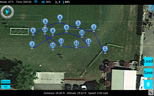
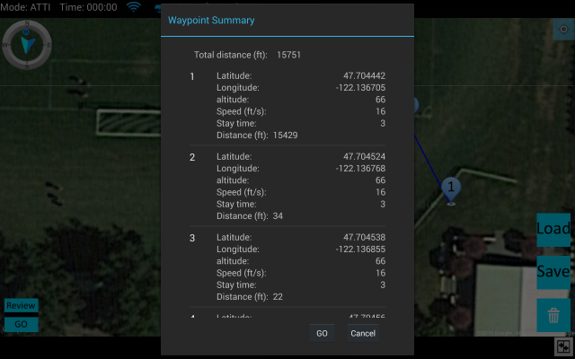
This is a short summary of how waypoint flight has been implemented (including some images of screens, just ignore the ugly buttons):
* Waypoint missions are limited to 16 waypoints; this is a limitation in the Phantom and when I had increased it the Phantom failed to fly so the limit is hard coded
* By default waypoint limits are in-place and match the Vision app for distance and total flight distance. These limits can be configured, you can increase them, decrease them or turn them off. I erred on the side of caution and have them on by default, if/how you use them is up to you.
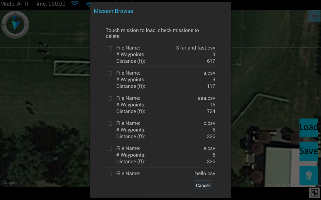
* Waypoint missions can be created offline and with no Phantom connection. Use full screen map mode, move to the location you plan on flying and create the mission. In this mode the 1st waypoint sets the limits anchor (if you have limits enabled). Missions can be saved. Once on location, load the mission and the Phantom becomes the anchor for the mission.
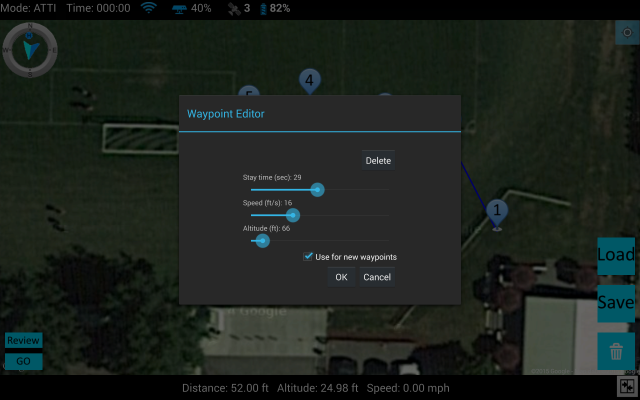
* Waypoint altitude, speed, etc all have configured defaults; set them as you with
* When creating a mission, if you edit a waypoint an option allows those edits to be used for all new waypoints thereafter for the same mission, no need to edit each waypoint or change defaults just because a location needs additional altitude for instance
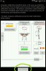
* If limits are enabled you will see a blue circle indicating the flight limit, if limits are disabled then no circle is shown
* Missions can be started from ground or flight; paused and continued; use S1 to cancel
* Flying waypoints shows a tail and head to the flight. There is a thin green line from where the mission began to the Phantom and a slightly thicker blue line to from the Phantom through the remaining waypoints
* Waypoint safety checker - How many times have you flown waypoints and forgot to adjust for the Phantom's reported ground altitude? The app automatically looks at the Phantom's altitude when on the ground and you start waypoint mission when any waypoint would put the Phantom closer than 10m to the ground you are shown a message and if you choose the app will add the Phantom's ground altitude to all waypoints.
General additions to the app since V1:
* A green circle on the map shows the point of no return. The value is reported by the smart battery and is said to indicate the max distance before you would need to return to home before auto-return to home is initiated (if you have enabled auto-RTH).
* DJI Zenmuse H3-3D, 3-Axis Gimbal with GoPro mode - in the advanced settings you can select this mode and the app will hide all irrelevant UI. Video and camera controls are removed from the flight screen since they do not function in this configuration.
* RTH - onscreen control
* Flight log - a list of min/max
* Flight tracks (disabled by default) records flight details every .5 seconds
Note: Flight track log is a work in process and is being tuned for use with other tools like DashWare.
Some imaged of GS: ignore the ugly buttons!