Litchi Mission Hub basically does the same thing but then the user has to do the error-prone calculations himself.
I've been hoping this feature to be built-in to Litchi as an option.
But even then the elevation data might be incorrect:
In many areas Google Earth uses SRTM (Shuttle Radar Topographic Mapping) data, which offers something like 16m vertical accuracy at 90m horizontal grid spacing. Google Earth doesn't use exclusively SRTM data, and some places augment it with higher-resolution datasets.
Individual points are fairly accurate in most cases where the terrain is fairly flat. In mountainous terrain the elevation data is less accurate because the point you are evaluating is not directly on a measured sample point and Google Earth is interpolating between measured points. If you are measuring a road that is in a canyon with steep walls, you can have some variations from point to point.
Google Groups
http://dds.cr.usgs.gov/srtm/version2_1/Documentation/MIL-PDF-89020B.pdf


.png")
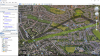
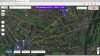
 so this was my effort, cant wait to try tomorrow
so this was my effort, cant wait to try tomorrow