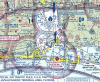
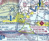
I'm trying my best to figure out where (if anywhere) I can fly under Part 107 in the Destin, FL area. I'll be down there for a wedding later this month, so if I can I'd like to use some photos/video for my website/promotional materials. It's not imperative, so I won't go through the trouble trying to get airspace authorization, so we'll rule the Class D airspace out. Sectional below:
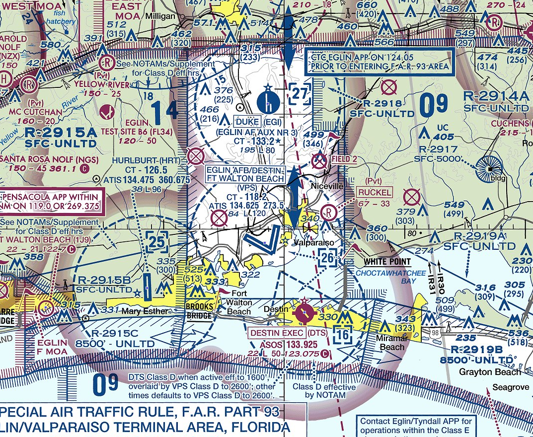
Thoughts:
-I was hoping Destin Exec (DTS) was one of those Class D's that would revert to Class G when inactive, but it looks like VPS overlay takes over when it's inactive, so it's still class D.
-That sliver of island beach right outside the 3 Class D airspaces, under the text "Fort Walton Beach" looked promising, it's National Seashore! Is that considered National Park territory? If so, then that's a no-go unless I go out on a boat or something into the water. Seems like it's the one area of opportunity where it's not Class D airspace, national parks, or restricted special use airspace.
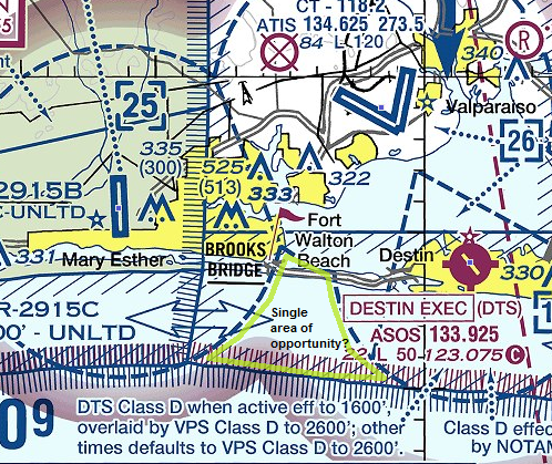
Honestly it seems like launching from a boat in this "area of opportunity" might be the only option, which is too much trouble for me, but I wanted to find out if my assessment was correct. What are your thoughts, comments?
VFR map link:
VFRMAP - Digital Aeronautical Charts
Thoughts:
-I was hoping Destin Exec (DTS) was one of those Class D's that would revert to Class G when inactive, but it looks like VPS overlay takes over when it's inactive, so it's still class D.
-That sliver of island beach right outside the 3 Class D airspaces, under the text "Fort Walton Beach" looked promising, it's National Seashore! Is that considered National Park territory? If so, then that's a no-go unless I go out on a boat or something into the water. Seems like it's the one area of opportunity where it's not Class D airspace, national parks, or restricted special use airspace.
Honestly it seems like launching from a boat in this "area of opportunity" might be the only option, which is too much trouble for me, but I wanted to find out if my assessment was correct. What are your thoughts, comments?
VFR map link:
VFRMAP - Digital Aeronautical Charts