Advice for best setup for P4P + v2 for mapping and photogrammetry

Joined
Dec 14, 2023
Messages
5
Reaction score
2
Age
42
Hi

We bought a P4P+ V2 last year to dip our toes into using it for surveying and producing orthomosaics for looking at rivers/fish habitat.

Finally got round to sorting out my certification too be able to fly it here in the UK but just wanted to see what people thought would be the best setup.

We bought the unit 2nd hand and we shouldn't have gone for the + model I understand now as this limits setting up for automated missions as the +controller can't really have software put on it (I have manged to get it work with Litchi by sideloading APKs on it but its really glitchy and not something I would put much faith in), so we need to buy another controller.

I wanted to check what is the right controller we need to get now. Is it the GL300L?

I also wanted wanted to see what people recommend at present for a device to pair this with. Ideally don't want to pay anything and use the android device I currently have but open to purchaing something else if it will be better.

Just starting to look at how we will use it so don't want to commit to paying a lot for software yet so was going to go down the Litchi route and use WebODM. We have an ArcGIS pro licence we can use for orthomosaics too.

Also not sure if we can get away without using GCPs just now and just manually lining up orthomosaics using GIS, but would be good to hear what people recommend?

Thanks

Graeme
 
  • Like
Reactions: CoreySnipes
Hi Graeme,
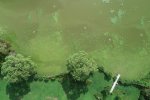
I currently fly a P4P_v1 and use the free version of Map Pilot Pro (by Maps Made Easy) for my ortho mapping. My firm does environmental work and I've used Map Pilot Pro for mapping the extent of invasive lilies in a local algae choked lake. Their processing and stitching service is pay-as-you go (you buy credits) and I find it quite reasonable. Attached is one of the tiles. I've had 275 orthos processed for about $30US. I can't advise you on the hardware. I'm sure others here will chime in to help you with that.

DJI_0454 (2020_08_25 20_31_58 UTC).JPG
 
I wanted to check what is the right controller we need to get now. Is it the GL300L?
Yes .. you need the GL300L.
The similar controller for the original P4 pro would be incompatible.
I also wanted wanted to see what people recommend at present for a device to pair this with. Ideally don't want to pay anything and use the android device I currently have but open to purchaing something else if it will be better.
If you are familiar with Android, stick with that.
It could be that your current phone or tablet is just fine.
Here's a list of many devices that work well:

If you end up doing a lot of mapping, an 8" tablet might be better, as it makes it easier to see details in the map setup page.
so was going to go down the Litchi route and use WebODM. We have an ArcGIS pro licence we can use for orthomosaics too.
Litchi is not a suitable program for mapping missions.
Check out DroneDeploy.
Unless something has changed you can use it as long as you like and only pay if you use them to process the images.
Also not sure if we can get away without using GCPs just now and just manually lining up orthomosaics using GIS, but would be good to hear what people recommend?
Only use GCPs if you are wanting survey accurate maps that tie into your local map datum.
Without going to that level you can output your orthomosaics as a geo-tiff and open in Google Earth and use the Google Earth tools to measure etc.
S%20map_1-X4.jpg
 
I agree with what's already been posted. I use an iPad mini, and DroneDeploy or Pix4D Capture (both free) for mission planning and flying, and I use WebODM for processing. I think Litchi is worth having anyway, because it's really nice for setting up repeatable photo and video shots. That's not for mapping, but often proves useful for getting shots of site context, etc.

I mostly process without GCP, but I am starting to get more involved with them as ground truth is increasingly important in my work and I also want to develop a better practical understanding of GCP, check points, and RTK. If your flight plan is good and your coverage is good, your orthos will be internally pretty consistent and shifting them in GIS should work fine in most cases. If your project requires high positional accuracy you can look at GCP and possibly RTK/PPK but you should be fine starting where you are.
 
  • Like
Reactions: fishy_pilot
I'm a hydrologist/geomorphologist and picked up a P4 RTK with a GL300N controller a couple of years ago for fishery and river work as well. Prior to purchasing, I hired a pilot with a P4P to fly projects for me and then processed the images myself using the 3DSurvey software. For this kind of work I don't need super high accuracy and the only reason I went with the RTK version rather than the P4P V2 was to reduce the number of ground control points I need to put down. Beyond that, the planning, flight pattern and image processing workflow for the P4TK is the same as the P4P. I always plan the flights using 2D or Terrain Awareness modes. 3D mode hasn't proven itself to be very useful.

To get any kind of accuracy for your maps or orthophotos, you will need to use GCPs. Until this summer, I would survey-in the ground control points with a total station or hire a surveyor to shoot them but bought a pair of Emlid Reach RS3 units this year for that purpose. The Emlid units are also extremely useful for shooting channel cross sections and thalweg profiles. I'm nearing retirement and have been doing river and fishery work for forty years but the Phantom 4 and Emlid equipment have been the best tools I've acquired since using a total station in the 90's. Best of luck.
 
Hi Graeme,
I currently fly a P4P_v1 and use the free version of Map Pilot Pro (by Maps Made Easy) for my ortho mapping. My firm does environmental work and I've used Map Pilot Pro for mapping the extent of invasive lilies in a local algae choked lake. Their processing and stitching service is pay-as-you go (you buy credits) and I find it quite reasonable. Attached is one of the tiles. I've had 275 orthos processed for about $30US. I can't advise you on the hardware. I'm sure others here will chime in to help you with that.

View attachment 125657
Cool, thanks.

I'd discounted using a online sevice as thought the costs would be higher than were justiafiable for us but thats pretty reasonable.
 
Yes .. you need the GL300L.
The similar controller for the original P4 pro would be incompatible.

If you are familiar with Android, stick with that.
It could be that your current phone or tablet is just fine.
Here's a list of many devices that work well:

If you end up doing a lot of mapping, an 8" tablet might be better, as it makes it easier to see details in the map setup page.

Litchi is not a suitable program for mapping missions.
Check out DroneDeploy.
Unless something has changed you can use it as long as you like and only pay if you use them to process the images.

Only use GCPs if you are wanting survey accurate maps that tie into your local map datum.
Without going to that level you can output your orthomosaics as a geo-tiff and open in Google Earth and use the Google Earth tools to measure etc.
S%20map_1-X4.jpg
Thanks. I used something to to a quick test flight before but can't remember what it was. I knew i used Litchi to do the mission though.
 
I agree with what's already been posted. I use an iPad mini, and DroneDeploy or Pix4D Capture (both free) for mission planning and flying, and I use WebODM for processing. I think Litchi is worth having anyway, because it's really nice for setting up repeatable photo and video shots. That's not for mapping, but often proves useful for getting shots of site context, etc.

I mostly process without GCP, but I am starting to get more involved with them as ground truth is increasingly important in my work and I also want to develop a better practical understanding of GCP, check points, and RTK. If your flight plan is good and your coverage is good, your orthos will be internally pretty consistent and shifting them in GIS should work fine in most cases. If your project requires high positional accuracy you can look at GCP and possibly RTK/PPK but you should be fine starting where you are.
I think we might end up needing more accuracy down the line so finding it good to see how that stuff (RTK/PPK) all works as I hadn't really considered any of that before.
 
  • Like
Reactions: CoreySnipes
I'm a hydrologist/geomorphologist and picked up a P4 RTK with a GL300N controller a couple of years ago for fishery and river work as well. Prior to purchasing, I hired a pilot with a P4P to fly projects for me and then processed the images myself using the 3DSurvey software. For this kind of work I don't need super high accuracy and the only reason I went with the RTK version rather than the P4P V2 was to reduce the number of ground control points I need to put down. Beyond that, the planning, flight pattern and image processing workflow for the P4TK is the same as the P4P. I always plan the flights using 2D or Terrain Awareness modes. 3D mode hasn't proven itself to be very useful.

To get any kind of accuracy for your maps or orthophotos, you will need to use GCPs. Until this summer, I would survey-in the ground control points with a total station or hire a surveyor to shoot them but bought a pair of Emlid Reach RS3 units this year for that purpose. The Emlid units are also extremely useful for shooting channel cross sections and thalweg profiles. I'm nearing retirement and have been doing river and fishery work for forty years but the Phantom 4 and Emlid equipment have been the best tools I've acquired since using a total station in the 90's. Best of luck.
Thanks for the reply.

Just getting my head round RTK stuff just now and keep hearing the Emlid stuff getting praised so will need to take a deeper dive into that stuff soon.

Currently we are just looking at using the drone to assist with doing walkover habitat surveys looking at river substrate in respect to spawning, juvenile, and habitat for salmonids, and to assess the ongoing effect of work done to alleviate excessive erosion in places.

A few organisations here are looking at using them for redd counts using SfM and machine learning which will interesting to see how they do.

I definitely think we will need to go more accurate in the near future but we will need to build the cost of a RTK system into a funding bid for a new project. I've bought a set of GCPs but not got anything more accurate than consumer GPS at the moment.
 
I think we might end up needing more accuracy down the line so finding it good to see how that stuff (RTK/PPK) all works as I hadn't really considered any of that before.
You can achieve accuracy of around a foot without GCPs or RTK.
With GCPs you can bring that down to a couple of inches.
How much accuracy do you really need?

I really doubt that you need centimetre level accuracy for habitat surveys.
 
A few organisations here are looking at using them for redd counts using SfM and machine learning which will interesting to see how they do.
I'm currently working with a conservation group to develop and document an open workflow for object detection and counting in drone mapping. Basically, drone photos -> orthomosaic -> count/locate detected objects in GIS. Our target is sea birds in a coastal environment, but I am documenting things so someone working in another domain can follow the steps. This is early work with lots of open questions but I should have something share-able in April 2024 ish.

I'd appreciate any connections to others working this area, and I can keep you in the loop if this of interest to you.
 
In case someone does a lot of photogrammetry work and need a fast, convenient and simple way of sharing their work with clients, we develop Map Hub Atlas give it a try and let me know what you think. It's free simply because it still not in product stage.
For my photogrammetry work I use combination of Phantom 4 Pro v2 with Topodrone PPK module, Topodrone software for PPK processing, Open Drone Map for processing map rasters and out baby Map Hub for sharing the work.
 
  • Like
Reactions: CoreySnipes
Hi my phantom 4 pro+ remote controller map is showing blank after update.
And I try to install DJI 4 go into my controller but couldn't please help
 

Recent Posts

Members online

No members online now.

Forum statistics

Threads
143,094
Messages
1,467,602
Members
104,980
Latest member
ozmtl