


Since there isn't a SCIENCE forum-
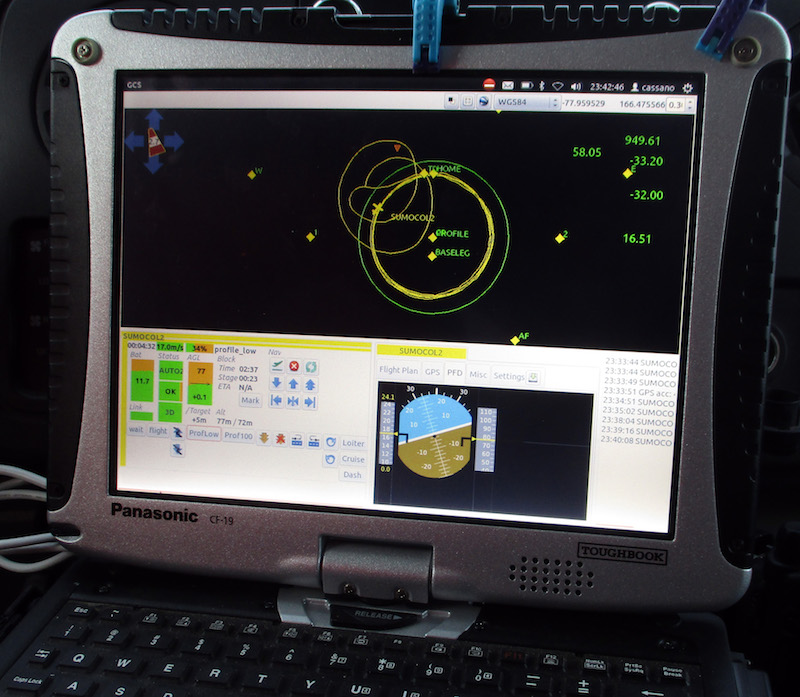
this is "surveying" of the boundary layer of the atmosphere (500-850m +/-) done by a SUMO sUAV.
SUMO Flights – Antarctic UAVs
anyone recognize the software?
this is "surveying" of the boundary layer of the atmosphere (500-850m +/-) done by a SUMO sUAV.
SUMO Flights – Antarctic UAVs
anyone recognize the software?


