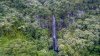
Very nice place.
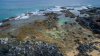
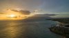
I took this panorama there a while ago with the Phantom 2:
http://photographysamplesnyc.com/Waimoku/
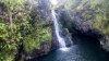
Last time I have been there they blocked the waterfall after the small river for public.
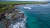
This here is my favorite I shot on Maui:
http://photographysamplesnyc.com/Kipahulu/
Have fun!
How did you get those 360 pics? It's a part of the phantom 2 app or something else?