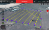
Question. Is POI altitude relative to the ground (0' would point to the ground regardless of aircraft altitude) or relative to the aircraft's altitude (so if I wanted to focus on ground level while flying @ 300' I'd have to set the POI to -300')? Latter would seem kind of strange since if your WPs are various heights point at same POI it really wouldn't work properly.
Okay the POI auto focus will adjust the gimbal pitch itself depending on the waypoint altitude, all that matters is that you select the correct POI setting altitude, which in your case would be -100ft, try it, change a way points altitude now click to the next way point and back to the one who's altitude you just changed, and you will see the gimble pitch has changed. Thats why you noticed your POI auto focus worked like a charm.
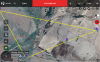
The invisible wand on MP is a cool idea, personally I wouldn't trust it's topology, infact I wouldn't trust any topology, what if there has been some recent structure erected there, when I set up out of range autonomous missions I always fly too high the first time and work down from there, even if that means I run, review the video and adjust the mission 3x. I do run missions very very far away so the topology could be massively different from home point.
If you undershoot a WP altitude and said WP is over flat land you wont necessarily come crashing in to the floor, infact you have a good chance of the phantom landing!
Last edited: