
- Joined
- Jul 29, 2015
- Messages
- 40
- Reaction score
- 10
- Age
- 77


Thank you for the reply. I will test it out.Depending on what version of the app you have will severely effect distance to.. If you have the latest version of the app or the one just before that. your max range will be about 1/2 of what it used to be able to go..
No .. There are are many factors that can affect your distance but the app isn't one of them.Depending on what version of the app you have will severely effect distance to.. If you have the latest version of the app or the one just before that. your max range will be about 1/2 of what it used to be able to go..

No .. There are are many factors that can affect your distance but the app isn't one of them.
I've gone just as far and further with the latest version.
Here's an example ... Was at only 15-20 metres height for most of the flight, you can see how far out it went.
iedI Know there can be other stuff that can also effect range. But the last 2 versions of the app they now took out a lot of the channels. which can and does cut down range at least were Im at. Being that channels 13-20 Which are all thats aval dont get as strong and clean of a signal as the ones below ch 13 did..
When i test out distance I usually tend to fly 1 of 2 routes.. On if directly north of my house in a straight line at about 300-400 feet I was always able to get almost 2 miles.. Now i cant even but a mile. Ive if I go up higher only gets me to about as far.. Then if I fly directly east and follow the very same flight path that before i was able to get about 3 miles at 400-700 feet high. Now I cant get past 1 mile. and the app is the only thing thats changed and im still on the same firmware as I have had. and nothing else has changed. and lots of others have had the same problem. now that dji took the good clear channels out in the last app.
I tried leaving the horizontal setting blank instead of the preprogrammed 500meter max, but it does not work. The app resets it at 500 m automatically.
I admire you guys that fly out over water like that. Balls of steel... If I had water around I might, and I say "might" very cautiously, go out where I could still see it but to take it past the line of sight knowing that if that bird came down it's history.... that takes balls of steel.No .. There are are many factors that can affect your distance but the app isn't one of them.
I've gone just as far and further with the latest version.
Here's an example ... Was at only 15-20 metres height for most of the flight, you can see how far out it went.
")
But the photo ops flying over water are so much better. Took this about 1.2 miles off shore.I admire you guys that fly out over water like that. Balls of steel... If I had water around I might, and I say "might" very cautiously, go out where I could still see it but to take it past the line of sight knowing that if that bird came down it's history.... that takes balls of steel.
Nice... Were you in the boat or you flew out to the boat?But the photo ops flying over water are so much better. Took this about 1.2 miles off shore.
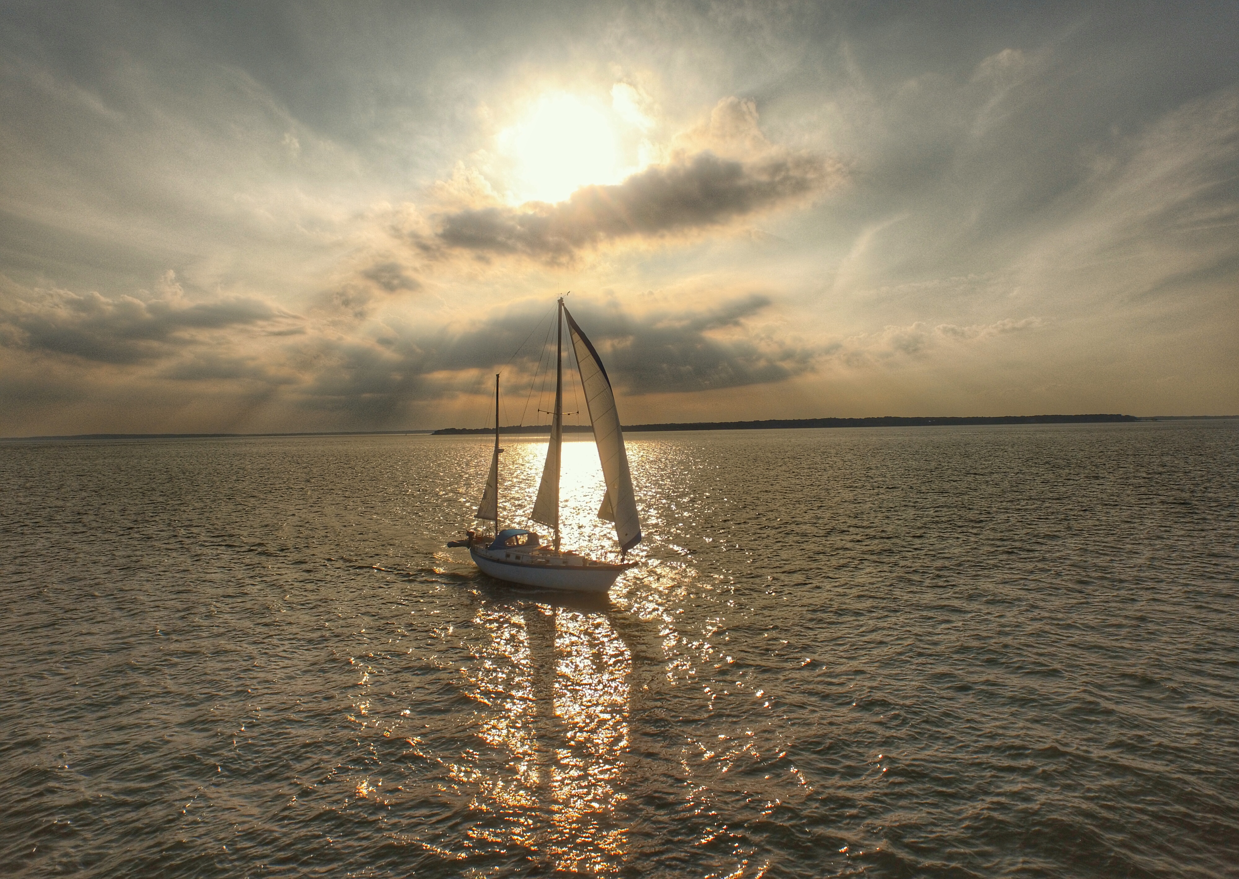
Flew out. Was chasing a yacht that turned out to be moving much faster than I thought it was, so I turned around. Got this shot on the way back.Nice... Were you in the boat or you flew out to the boat?
Also how do you guys pull up the maps of your flight???
15-20 meters over the water for 2 miles each way. That's awful brave as I'm sure some small birds flying low could have turned it into sea toast.No .. There are are many factors that can affect your distance but the app isn't one of them.
I've gone just as far and further with the latest version.
Here's an example ... Was at only 15-20 metres height for most of the flight, you can see how far out it went.
In the DJI Pilot app, go to the user centre and click on the paper plane icon in the centre to bring up your flight logs.Also how do you guys pull up the maps of your flight???


