You're certainly entitled to think whatever you like but if you saw the actual imagery Google provides in the area I was required to work in, and if you understood the type of waypoint missions I was expected to create - then it would be obvious that I didn't understate anything.... But why bother asking a few questions to understand the situation fully when it's so much easier to just go ahead and pass judgement immediately by filling in all of the unknowns with the most negative thing you can imagine.
In general terms - when you pay "X" dollars for something that you expect to be usable 100% of the time and then discover that it's actually only usable 50% of the time, is it really all that nutty to think that a 50% refund would be fair? What if it was your ISP and you expected to have internet access all month and paid a price you thought was fair for that - but then you discovered that you actually only had internet access on even numbered days and you were going to have spend additional money to get access to something you already thought you had paid for. Would you still think it was nutty?
I think it's a bit nutty to comment on something that was written 2 months ago when the author was admittedly frustrated - and to belittle his problem without understanding it as well as to call him nutty for making some off the cuff remarks about price vs usability which are really not all that unrealistic depending on your perspective. Did you honestly think those comments would be well received and/or help move the conversation forward productively? Did you read the rest of the thread before posting to see if perhaps the problems had somehow been resolved to mutual satisfaction? (In fact it has!)
In the future, please think twice before posting something that is clearly antagonistic - and if there is no value in doing so - save yourself some keystrokes and go have a beer instead of sending that message.
For anyone else stumbling upon this thread - AutoFlightLogic was awesome in assisting me to a mutually satisfactory resolution. (I did not ask for or receive any kind of refund.). I can't think of another company on the planet that would have done what they did for me. I ended up with the background imagery I needed in order to complete my job. I guess I'm a little better at the waypoint missions than erikgraham is because my missions flew flawlessly, first try without any of the "required" adjustments or error corrections that his missions require.
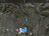
Here are some pics that show my before and after.
The first two images are the exact same location. The first uses the default Google tiles. The second uses updated imagery i created myself.
View attachment 62366
View attachment 62367
View attachment 62368