Auto RTH failed - worked out for the best

Joined
Dec 25, 2015
Messages
175
Reaction score
90
Age
48
Location
Oregon
last weekend I was hanging out at Cannon beach in OR near Goonie rock / Haystack Rock. It's roughly 360 feet high and I was flying around it taking photos and videos. Second or third battery in, I took the bird to the back side and lost signal.

I made two mistakes, lessons learned (hopefully).

1. I knew I wasn't high enough to see the bird on the other side of the rock, started losing signal but kept flying behind the rock. I wasn't terrified as I could just walk around the beach a little to regain signal. I was only a few hundred meters away if that. Keep LOS, got it...

2. I didn't reconfigure the RTH to hit 120 meters on return if signal lost. I didn't even think of this until I nearly shat my pants and realized if RTH worked as expected, the bird was going to kiss the rock...

a quick walk around the rock a little and I picked up the signal again only to find the bird hovering where I left it (thankfully, and in reality, it wasn't such a quick walk, there was some butt puckering and, well you get the picture)

if you've made it this far, thanks. I've been looking at the logs, but don't know enough to read them well yet. Lookin for anyone to pitch in and give me an idea on where I went wrong, or if the aircraft had a fault with RTH.

HealthyDrones.com - Innovative flight data analysis that matters

this flight was with either the iPad air 2 or iPhone 6s+ (I alternated and this could be my other problem with different settings)

thanks in advance
 
  • Like
Reactions: eaglegoaltender
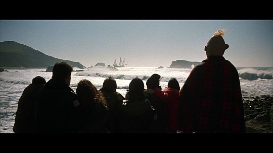
Haystack_Rock.jpg


Goonie Rock. overall, it was a decent day
 
Wow - quality shot there "lookinforpain" - nice job. Your name says it all - you went looking for pain and I guess you found it on that flight - lol. I can only imagine the pain of loosing signal especially when you sort off expected it. Glad all worked out well for you - beauty shot for certain, nice job with that and getting your Phantom home again. Safe flying and filming!
 
  • Like
Reactions: lookin4pain
From your story it sounds like you just didn't lose control signal for long enough for it to kick in to return to home. Lucky you
 
Last edited:
One phantom three I got I decided it was going to be my long-range bird. Upon registering it I named it lucky bird, I had nothing but problems with this bird from the start !lost signals ,wouldn't fly past 300feet,sometimes wouldn't pick signal up at all,in areas where I can fly miles with other ones! I send it back, got a different one ,gave it a different name and it's made it miles.i'm convinced it was because I named it "lucky."
I worry about a profile named "looking4pain"

Good luck!
 
  • Like
Reactions: eaglegoaltender
One phantom three I got I decided it was going to be my long-range bird. Upon registering it I named it lucky bird, I had nothing but problems with this bird from the start !lost signals ,wouldn't fly past 300feet,sometimes wouldn't pick signal up at all,in areas where I can fly miles with other ones! I send it back, got a different one ,gave it a different name and it's made it miles.i'm convinced it was because I named it "lucky."
I worry about a profile named "looking4pain"

Good luck!
Hi dirtybum. You're worried about a monica called looking4pain? Mmmmmm.
 
  • Like
Reactions: lookin4pain
last weekend I was hanging out at Cannon beach in OR near Goonie rock / Haystack Rock. It's roughly 360 feet high and I was flying around it taking photos and videos. Second or third battery in, I took the bird to the back side and lost signal.

I made two mistakes, lessons learned (hopefully).

1. I knew I wasn't high enough to see the bird on the other side of the rock, started losing signal but kept flying behind the rock. I wasn't terrified as I could just walk around the beach a little to regain signal. I was only a few hundred meters away if that. Keep LOS, got it...

2. I didn't reconfigure the RTH to hit 120 meters on return if signal lost. I didn't even think of this until I nearly shat my pants and realized if RTH worked as expected, the bird was going to kiss the rock...

a quick walk around the rock a little and I picked up the signal again only to find the bird hovering where I left it (thankfully, and in reality, it wasn't such a quick walk, there was some butt puckering and, well you get the picture)

if you've made it this far, thanks. I've been looking at the logs, but don't know enough to read them well yet. Lookin for anyone to pitch in and give me an idea on where I went wrong, or if the aircraft had a fault with RTH.

HealthyDrones.com - Innovative flight data analysis that matters

this flight was with either the iPad air 2 or iPhone 6s+ (I alternated and this could be my other problem with different settings)

thanks in advance

Thank you so much for the story. I plan on flying my P3A there too as soon as the weather clears up along the coast. I was already wondering what would happen if it was flying too low on the other side of the rock.

I assume nobody gave you any trouble flying at that location?
 
I assume nobody gave you any trouble flying at that location?

I had a couple of gawkers that stopped and we talked. I showed them the live feed and their jaws dropped until they heard the price. For the most part it was well perceived. Most people didn't really even know. It was only obvious when I was taking off or landing, between that and my backpack for the bird with the remote. Otherwise most just left me alone not knowing.

I'll be going back to get a few sunset photos, maybe some more with the fog. and there's a lighthouse just north I'm gonna try for. I would have that day but I had already spent my batteries below 50% and wasn't willing to risk it. Just waiting for decent weather again...

That is so cool. I kind of expected that. I sometimes bring my Traxxas nitro RC Cars and run them along the beach, and I have never had anyone complain. Like you, I usually have a lot of lookers that will come over and ask about the cars.

You will have to let us know how the light house goes. That should result in some awesome pictures/videos. If memory serves me right, it is quite a ways north of Haystack Rock and the beach ends at the cliffs just north of Haystack Rock.. I would be interested in knowing the distance you travel and where you took off from.

The lighthouse will be a challenge because they have a good chunk of the cliffs blocked off due to erosion from some storms. Now that you mention distance, I might have to take several test flights first as I've been having issues with distance. I can barely make the trip. The furthest my bird has flown before losing connection is 1.26 miles. Not sure I have balls big enough yet to make a 2 mile hike over water. I could hike up in the hills if I'm lucky and cut the distance down a bit, but not ready to chance it just yet.

If you make it before I do, it'll be interesting to see how it goes for ya

upload_2016-2-11_14-16-52.png
 
If there is no wind, I could see making the run. I would want any breeze coming from the North so that I would be flying into the wind going and then with the wind coming back. I have the copper windsurfer range extenders on the antennas and the bird would always be in the line of sight so it should not be a problem (I would actually be further south than your mark so I would always have the bird in line of sight and not blocked by Indian Point). I would also always want the bird above the height of the lighthouse so there would not be a chance of hitting it on the circle. I am a big believer of having more altitude than I think I need (as long as it is under 400 feet), than the other way around.

Depending on the battery %, I might even be tempted to use the point of interest feature to circle above the light house, but I would want to be at least 60% battery before trying anything like that.

watch for low flying tourist... I did see a fixed wing buzzing around the rock when I was there and I could have clearly reenacted mythbusters frozen chicken through the cockpit windshield if I wasn't paying attention.

I also have some copper windsurfers and that's the only way I got the distance I had. Might be too much noise in the area I tested.

Guessing no one saw any issues with the logs to identify why the bird didn't RTH after 82.2 seconds of no signal
 
Guessing no one saw any issues with the logs to identify why the bird didn't RTH after 82.2 seconds of no signal
The HD report indicates Downlink data connection lost for 82.2 seconds.
It's not saying that you lost connection, just that the controller was getting no signal from the Phantom.
To trigger failsafe RTH, the Phantom has to lose signal from the controller for 3 seconds.
The Phantom was probably just hovering waiting for you to tell it what to do and would have responded if you had given it some control input.
this flight was with either the iPad air 2 or iPhone 6s+ (I alternated and this could be my other problem with different settings)
Those settings are stored in the Phantom rather than the device so that when you lose signal, the Phantom still has the settings.
 
  • Like
Reactions: lookin4pain
Yeah, I think I have seen the same person before, but if so, it is a glider that he launches up by hand and it sails up about 75 to 100 feet before gliding back down. He has a remote controller that allows him to steer as it is gliding back in and the whole trip lasts about 3 minutes or so. I have seen him there multiple days, but he always seems to stay south of Haystack Rock.

Shouldn't be a problem for me because I prefer to be up at 200 to 250 feet, and I don't think he would be able to launch the glider that high up....

I think meta4 above has it right. I think your bird still had a weak link but not a complete loss of signal, which would explain why it did not go to RTH mode.
 
The HD report indicates Downlink data connection lost for 82.2 seconds.
It's not saying that you lost connection, just that the controller was getting no signal from the Phantom.
To trigger failsafe RTH, the Phantom has to lose signal from the controller for 3 seconds.
The Phantom was probably just hovering waiting for you to tell it what to do and would have responded if you had given it some control input.

Those settings are stored in the Phantom rather than the device so that when you lose signal, the Phantom still has the settings.

Thanks Meta4

The RC showed weak signal on occasion, but then it appeared to have lost both HD and RC signal according to the ipad/iphone. Normally when this happens, I can sometimes recover it using the radar screen to at least see if I can point the aircraft in a different direction, however this time there was zero response.

I'd like to find a way to simulate this, preferably over land so I can get a better idea of what's going on before I make too many over water trips, especially that lighthouse in particular.
 
Yeah, I think I have seen the same person before, but if so, it is a glider that he launches up by hand and it sails up about 75 to 100 feet before gliding back down. He has a remote controller that allows him to steer as it is gliding back in and the whole trip lasts about 3 minutes or so. I have seen him there multiple days, but he always seems to stay south of Haystack Rock.

Shouldn't be a problem for me because I prefer to be up at 200 to 250 feet, and I don't think he would be able to launch the glider that high up....

I think meta4 above has it right. I think your bird still had a weak link but not a complete loss of signal, which would explain why it did not go to RTH mode.

this was clearly a fixed wing plane. I was up at 400', but close to the rock and he was south of the rock by about another 800' or so. not sure on his altitude, difficult to judge objects when you don't know the size and proper distance.

man, I really wish it was nice out, and I wasn't at work so I could put more flight time in vs sitting here...
I know what you mean. I have only been flying for about 3 weeks now, but I already have 58 flights, 12 hours of flight time and over 130 miles logged. Needless to say, I am hooked, and learning more and more each day.

What was your altitude when you ran into problems with the signal at Haystack Rock? Did you ever go up to the top of Haystack Rock, and if so, what was the altitude at the top?
 

Recent Posts

Members online

Forum statistics

Threads
143,094
Messages
1,467,590
Members
104,977
Latest member
wkflysaphan4