Aerial Measurment Question

Joined
Nov 6, 2016
Messages
47
Reaction score
16
Age
54
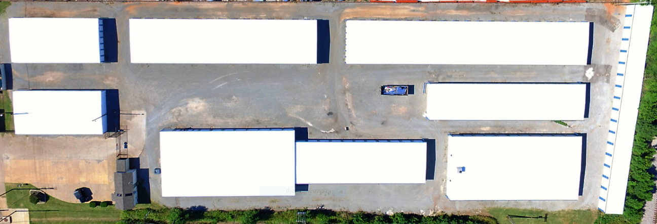
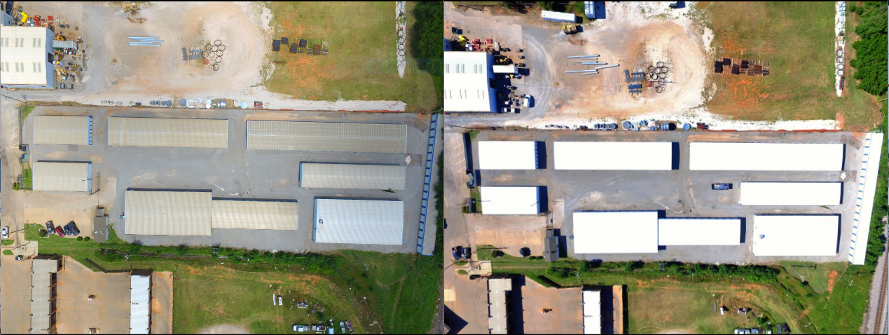
Can photos like these be used to calculate square feet of rooftops,
Since software and aps are constantly improving it seems a current question would be ok.
Providing these photos to customer for whatever reason they may like to use them for made me wonder if someone could use something like this to measure exact surface dimensions. That could save a lot of work as opposed to manually measuring?
What would be easiest way to do something like that. Thanks.
 
for sure but i was looking at this for flat roofs. This is a relatively flat roof.
I guess you could put two orange cones like 10,25,100 feet apart for reference.
But i don't think you could do easily scale it correctly from this high up using that method. notice the check in house thing looks narrow compared to the blue vehicle parked inside the gates.
 
Possibly it you were to fly at a known fixed altitude centered directly over a roof. It could be possible if the roofs were flat. You could make different formulas for different altitudes. If you had a laser type measuring device to measure roof peak to lower edge. You could do sloped roofs. I'm a retired pipe fitter. So you know how good my advice is. LOL
 
Absolutely this could (and IS) used for measurements.

Slope can be easily added after the fact for a final measurement. We do sqft measurements from flat surfaces every day (not with a drone but a blueprint) and then input the roof pitch and the REAL sqft of the roof.

In regards to using Aerial Images for measurements most of the time you'd have a Ground Control Point placed on the ground that you knew the dimensions of and use that to set your scale. Maybe a 4'x4' panel that is highly visible.

Ground Control Points

PropellerAero-AeroPoints.jpg


ApplicationsGroundSurvey-Control-Points.jpg
 
  • Like
Reactions: With The Birds
Assuming that the buildings aren't new and appear on Google Earth, you can use the tools/ruler/measure polygon function in Google Earth Pro to give you the area of each roof.

Another option might be to use special photo-measuring software such as UPhotomeasure (previously called iPhotomeasure) but like most other methods it will require some reference point(s) of known dimension(s). For best accuracy the drone should be directly above the roof you want to measure - but a slight skew (as in your first photo on the LHS) should not introduce too much inaccuracy, but would be dependent on drone height. Uphotomeasure says that it can deal with perspective measurement anyway.

Further details are here:-

uPHOTOMEASURE - Public Site Space - WebHome

 
  • Like
Reactions: phantom3intennessee
If you can physically measure one of the sides, then you can calculate the others based off of that. If other roofs were involved and were the same height and you remained roughly the same distance from them, then you could do a collection of them. But, once elevation changes come into play, it can become very difficult. One method to counter this is to place a known reference object on the roof or other object being measured Soo that you can scale off that object regardless of the altitude - once you can assign a measurement to that known object, everything else becomes relative.
 
Had my roof replaced last summer; the roofing contractor provided my quote from Google Earth.
 
Try dronedeploy, they have a 1 month complete trial. You'll be able to measure whatever you want and it's extremely accurate.
 
People seem to be forgetting 'perspective' ...

If you placed a known size panel or marker on the ground next to a building - the roof is nearer to the camera and therefore has different ratio of height to its dimensions than the marker.
It would be inaccurate calculation.

When I wanted to check out my estate borders and lengths of - I just flew over each point and noted the GPS. I compared to my Navigation GPS (I have a number of GPS units from work and my other 'hobby' of yachting). Its not really accurate - but good enough.

Few weeks back - I checked out a friends field with intention to create a Model Flying area. Again - I flew the field stopping at each corner noting coordinates. I was then able to calculate and compare to the Litchi data dimensions.

Obviously as you reduce size of item you wish to measure this way will increase the error, GPS is not as accurate as people think.

Just commenting.

Nigel
 
As Tchit has said above, Drone Deploy or Pix4D softwares are capable of create point clouds where every point is referenced in three coordinates and you can measure any distance between two of them disregarding the slope, inclination or perspective, because software creates a referenced cloud. Precision of these measures can be really good, in the order of few centimetres or even less. This will depend on the distance you took your photos, the sensor and camera lens, and the software will tell you each time.
The other side of the coin is that you have to create first that point cloud, and this will need many photos with quite an overlapping among them, and a lot of processing time...
So, to the initial question posted we can say: YES! One can measure distances and areas (and volumes), but at a cost of time and computing power.
 
Thanks for the helpful info guys, I have a before shoot this week that I'll compare what I think the Sq. ft. is to the contractors/my customers measurements are and see how accurate it is using markers and possibly drone deploy.
 
my primary function is to provide before and after photos but as a bonus to customer thought it would be great if somehow we could also assist in measurement.
The drawback could be in my experience that it may be less likely to get the contract if you do not take the time to measure the old fashion way.
eg. the first two guys who bid a job come out and measure spending more than an hour. Then here you come and within ten minutes have a quote.
Customers are fickle that way and may award the work to the guy who seemingly put more effort into it.
 

Members online

No members online now.

Forum statistics

Threads
143,087
Messages
1,467,534
Members
104,965
Latest member
cokersean20