2 Flight Loggers in Ultimate Flight App

Joined
Feb 1, 2014
Messages
4,308
Reaction score
936
Location
Indy, USA
Now that I finally received my new vPlus V3 (refurbished), I can get back to.....the good stuff. After digging around some in the app I was able to stumble upon the .csv files for 2 flight loggers. One is app related, and the other flight logger focuses on the Quad itself. The app related logger will most likely not be used in any way. The Quad Flight Logger is full of Super Data!!!

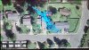
kenargo has taken advice very well up to this point and we will have the perfect setup once it's finalized. Most importantly the flight logger is currently able to read and used to diagnose most all issue. There is some data that is currently not yet on it, but should be easy to include. The current downfall of this flight logger is that none of the data can be used with Dashware. If it's possible, the names of each data column will need renamed in order to be used with the profile logger in dashware.

I have taken some screen shots showing what data is currently on kenargo's Ultimate Flight app. You wont see the full data name is some of the columns. I was going to break it down but knowing the names need changed I decided not to. Btw, for this Flight Logger to be most powerful, we need the names to match the names found in the Flytrex flight logger. These loggers need to co-exist with one another in the way of name language. If for some unknown reason that these names can not be changed, as last resort a completely new logger profile will have to be created/built. Should that happen, none of the current 100 or so gauges we've been using, will able to be used.

The data in the images is from my quad which was recorded while sitting and not moved. Because of this you will see nothing recorded. The "0".


This image shows data that you see in the app. As I say it's .csv file will most likely not be needed or used anywhere.
 

Attachments

  • 1UF1.jpg
    1UF1.jpg
    577.3 KB · Views: 608
  • 1UF2.jpg
    1UF2.jpg
    595 KB · Views: 567
  • 1UF3.jpg
    1UF3.jpg
    643.5 KB · Views: 521
  • 1UF4.jpg
    1UF4.jpg
    227.9 KB · Views: 541
  • 1UF5.jpg
    1UF5.jpg
    174.8 KB · Views: 566
Nice list of data points. I would imagine it will not be long until Flytrex includes this (now that the canbus cable is in the wild) stuff as well. I've also been meaning to shoot Amit at Flytrex an email asking him to provide the flight log (the data the flytrex unit sends back to the server) as a downloadable csv so we can just get home and load it directly into Dashware instead of having to pull it off the bird. Should be a slam dunk as far as what's required by his guys... the data is obviously already there.
 
bbfpv said:
Nice list of data points. I would imagine it will not be long until Flytrex includes this (now that the canbus cable is in the wild) stuff as well. I've also been meaning to shoot Amit at Flytrex an email asking him to provide the flight log (the data the flytrex unit sends back to the server) as a downloadable csv so we can just get home and load it directly into Dashware instead of having to pull it off the bird. Should be a slam dunk as far as what's required by his guys... the data is obviously already there.

I have mentioned some of what you said to Amit a number of times. It's always a great idea and we are looking to add that in the next release. It never happens. I emailed Amit and Cc Rebecca 3 weeks ago with no response. It's easy to get pissed off at those people. I really like them when they are on point, but when they're not it can be hard to keep from blowing up about it.

But yeah the flytrex has always logged as much(not the same data) data as I have in the images. They use a fraction of the data, or I should say allow the user limited access of the data. I have not seen what kind of data I can get to with the canbus adapter yet.
 
I have taken some screen shots showing what data is currently on kenargo's Ultimate Flight app. You wont see the full data name is some of the columns. I was going to break it down but knowing the names need changed I decided not to. Btw, for this Flight Logger to be most powerful, we need the names to match the names found in the Flytrex flight logger. These loggers need to co-exist with one another in the way of name language. If for some unknown reason that these names can not be changed, as last resort a completely new logger profile will have to be created/built. Should that happen, none of the current 100 or so gauges we've been using, will able to be used.


Names are easily changed; at the time and if you have a list of names I'd be happy to update the column names to accommodate. Hopefully latitude and longitude are OK unchanged; I updated those a few versions back to be able to import your flight into http://www.convertcsv.com/csv-to-kml.htm for mapping track to Google Map.

Let me know and I can update with the next version...

Ken
 
kenargo said:
Forgot to check the notify... Now I'll get updates...

I just got back from flying over Kenargo's house. I could see he was in the middle of some satellite drift at the time. :lol:
 

Attachments

  • Kenargo1.jpg
    Kenargo1.jpg
    360.6 KB · Views: 408
Forgot to mention, I will work on a list. That trip back from Kenargo's was cold. Plus there is 1,827 miles between our houses.
 
flyNfrank said:
Forgot to mention, I will work on a list. That trip back from Kenargo's was cold. Plus there is 1,827 miles between our houses.


I think you set one heck of a new record for GS flight with that one!

Did you save the waypoint flight?
 
I checked the time display, it is millisecond and is human readable; it is excel that shows the value in scientific notation.

In the next version I've also changed the naming convention; if you load a mission file then the file name will be in the form: <mission name>-<date>-<time>.csv. I haven't quite figured out a convenient way to allow the pilot to enter the name for the flight without making it too intrusive but once I find a pattern I like I'll get that added as well.

I've also added changed the flight log (single line) information to include the mission name and start/end location details.

Let me know how you would like to see columns renamed and I'll accommodate.
 
I loaded Dashware to take a look and as near as I can tell all that would be needed is to create a profile and setup the mappings as appropriate.

Question to the experts with Dashware; if a profile was created for my app would it just work?
 
A profile logger can be created for your data, but you determine what data appears in the .csv file. Each column you add a name. That name has to match the data name coming from the Phantom (I usually say quad). Then each name has a profile which is where it determines how the data is read. If it sounds confusing, it's because it is confusing in my opinion. We could cover it much better detail while in google hangouts.

Now, the super duper easy way around everything is to use what the rest of the industry has been using which is flytrex names and everything else matches up. And more importantly we can use the existing 100 plus gauges that are already set to go. Otherwise you will need to build all new gauges to work with your profile info.

Here is a start. I have few more that needs added that I will pass along shortly.

A-Latitude
B-Longitude
C-altitude(feet)
D-ascent(feet)
E-speed(mph)
F-distance(feet)
G-max_altitude(feet)
H-max_ascent(feet)
I-max_speed(feet)
J-max_distance(feet)
K-time(milliseconds)
L-datetime(utc)
M-datetime(local)
N-satellites
O-tempature(f)
P-voltage(v)
 
flyNfrank said:
A profile logger can be created for your data, but you determine what data appears in the .csv file. Each column you add a name. That name has to match the data name coming from the Phantom (I usually say quad). Then each name has a profile which is where it determines how the data is read. If it sounds confusing, it's because it is confusing in my opinion. We could cover it much better detail while in google hangouts.

Now, the super duper easy way around everything is to use what the rest of the industry has been using which is flytrex names and everything else matches up. And more importantly we can use the existing 100 plus gauges that are already set to go. Otherwise you will need to build all new gauges to work with your profile info.

Here is a start. I have few more that needs added that I will pass along shortly.

A-Latitude
B-Longitude
C-altitude(feet)
D-ascent(feet)
E-speed(mph)
F-distance(feet)
G-max_altitude(feet)
H-max_ascent(feet)
I-max_speed(feet)
J-max_distance(feet)
K-time(milliseconds)
L-datetime(utc)
M-datetime(local)
N-satellites
O-tempature(f)
P-voltage(v)

Does it ignore unmapped columns and is there a profile with meters (all values from the Phantom are in meters as is the flight log)?
 

Members online

Forum statistics

Threads
143,087
Messages
1,467,536
Members
104,965
Latest member
cokersean20